Tomstrails GPS Duo app for iPhone and iPad
4.0 (
7760 ratings )
Travel
Navigation
Developer:
Tomstrails.com
Free
Current version:
3.0.0, last update: 3 years ago
First release : 19 Mar 2011
App size: 10.49 Mb
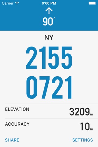
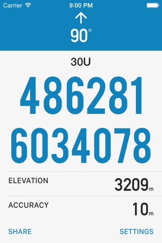
Provides a clear and concise display of your position in map coordinates used widely around the world.
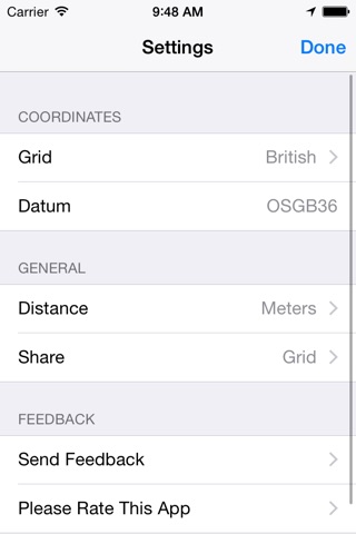
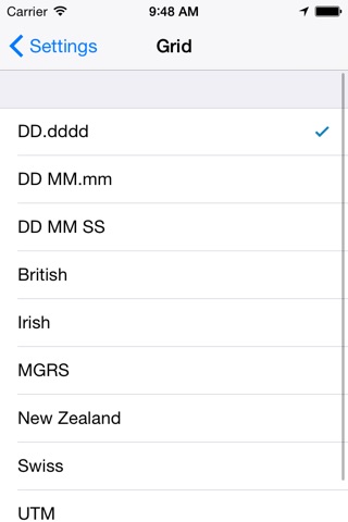
GRID FORMATS
• British Grid, used by Ordnance Survey in Great Britain.
• Irish Grid, used by Ordnance Survey in Ireland.
• MGRS (Military Grid Reference System)
• UTM used worldwide with both the WGS-84 datum and ED50 in parts of Europe.
• Latitude & Longitude in decimal and sexagesimal notation.
EXTENDED BATTERY LIFE
Tomstrails GPS optimizes the frequency of position updates depending on battery charge and speed of travel to make sure you can always make a call at the end of the day, great for multi-day trips. The GPS is never enabled when the app is in background.
CRISP, CLEAR DISPLAY
A clear, high contrast display ensures you can read the position quickly in any light conditions. Simultaneous grid formats allows emergency services to coordinate ground and aerial support.
Pros and cons of Tomstrails GPS Duo app for iPhone and iPad
Tomstrails GPS Duo app good for
Very clean and detailed I only suggest to put a share gps data feature by sms and e-mail (recurrence trigger option in configuration will be a nice plus)
I have been using this free app for quite some time in the field during search operations. It is simple and to the point when all you need is a set of coordinated to relay to command or arrange pick by helicopter. Sharing your location via text when radio comms fails is a significant plus for searcher safety. I did prefer the previous version that had both coordinate systems on one screen, but hey, how hard is it really to swipe a screen. On a side note. I still carry a dedicated gps unit as the antenna is far superior to an iPhone and a buttery change is possible after several hours or days in the bush.
Some bad moments
It works once but theres no update location button. Pretty much useless if you have to kill the app and load again to have updated info
This is a simple read out of your position in lat/lon and utm, exactly what I needed. Interface is clean and it appears to be accurate.
This is a nice, easy to read app, but it does not allow you to change the map datum. In fact, it is not clear which map datum is being used to generate the coordinates. The addition of this feature would greatly improve this app.
I was a GPS operator in an IDF infantry platoon, and we had very complex GPS devices for the task. They were strictly numerical displays though, and a solid main screen was key. All I need is the UTM coords, as well as altitude and accuracy. This app does that perfectly on one screen. The only thing Id suggest for improvement is an indicator for the number of satellites located.
Very nice. Also includes the ability to use grid coordinates, very handy when you are in the middle of the woods and do not have an address!
Really easy to use. Large fonts makes it easy to read. Accurate when measuring under clear skies.